Maximizing Survey Accuracy with Ground Control Point Markers
- Hudson Jace
- Aug 9, 2024
- 1 min read

Ground control points are essential markers used in aerial surveying to ensure accurate mapping and data collection. By strategically placing these markers on the ground and using them as reference points during drone flights, surveyors can maximize the accuracy of their surveys.

key aspect:
One key aspect of utilizing ground control point markers is their precise placement. Surveyors must carefully position these markers in known locations with accurate coordinates. This is crucial for creating a reliable reference system that the drone can use to calibrate its position and orientation during the survey.
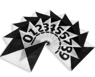
In addition to accurate placement, the quality of the ground control point markers is also important. Surveying Markers offers durable and high-visibility markers that can withstand various environmental conditions, ensuring that they remain visible and intact throughout the surveying process.
By using ground control point markers effectively, surveyors can improve the overall accuracy and quality of their survey data. These markers serve as anchor points that help eliminate errors such as distortion and misalignment in the final map or model generated from the drone survey.
conclusion: In conclusion, maximizing survey accuracy with ground control point markers is crucial for obtaining reliable and precise survey data. By investing in high-quality markers and placing them strategically, surveyors can enhance the efficiency and effectiveness of their aerial surveys. Surveying Markers provides the necessary tools and resources for surveyors to achieve optimal results in high-altitude mapping projects.


Comments