Drone Mapping Equipment: Essential Hardware, Payloads, and Software for High-Accuracy Aerial Surveys
- Sarah Johnson

- Nov 5, 2025
- 5 min read
Drone mapping has evolved into a core technology for surveying, construction management, mining operations, agriculture, and land development. As organizations move away from manual fieldwork and traditional ground surveys, drone mapping equipment provides fast, safe, and data-rich alternatives for collecting accurate geospatial information. Today’s mapping-grade drones combine high-resolution imaging, GNSS positioning, LiDAR sensors, and automated mission planning software to produce detailed 2D maps, 3D terrain models, orthomosaics, and digital surface models with centimeter-level precision.
Whether you are evaluating equipment for a new remote sensing program or upgrading an existing one, understanding the components that enable accuracy, efficiency, and repeatability is essential. This guide breaks down the core elements of drone mapping equipment, how these systems work together, and the recommended accessories and best practices required to deliver professional-grade results.

What Equipment Do You Need for Drone Mapping? (Quick Answer)
Drone mapping equipment typically includes:
A mapping-capable drone with a 20 MP+ global shutter camera
RTK/PPK positioning technology
GNSS ground control equipment (base station + rover)
Ground control points (GCPs)
Mission planning software for automated flights
Photogrammetry software for processing images
Optional LiDAR, thermal, or multispectral payloads
Accessories such as batteries, tablet, backpacks, landing pads, and ND filters
Professional workflows combine aerial imaging, high-precision positioning, and post-processing tools to generate survey-grade deliverables.
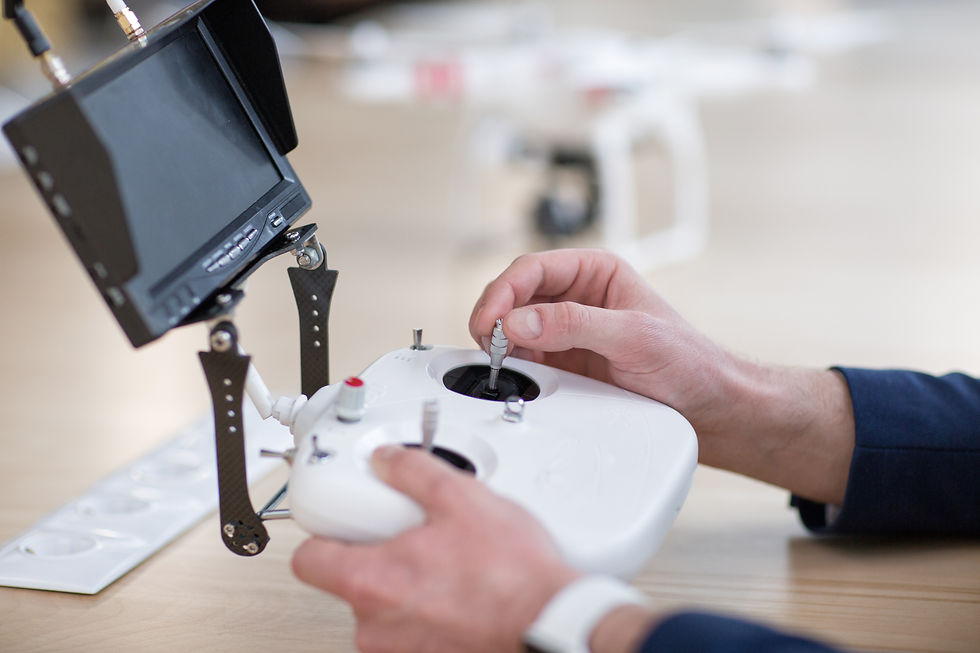
Core Drone Hardware for Mapping
The drone itself forms the foundation of the mapping system. For professional work, platforms should support:
Autonomous flight
Long battery endurance (30+ minutes)
Stable imaging gimbal
Compatibility with advanced payloads
RTK/PPK positioning
Camera Requirements
When mapping, sensor quality directly affects accuracy and output resolution. Key specifications include:
Global shutter (eliminates motion blur)
20 MP or higher resolution
Appropriate focal length for terrain mapping
Full-frame sensors for increased image coverage
Entry-level drones can map small sites, but larger builds, earthworks, and infrastructure planning benefit from enterprise-grade payloads.
RTK vs PPK: Positioning Technology for Precision
Drone mapping equipment often integrates Real-Time Kinematic (RTK) or Post-Processed Kinematic (PPK) modules to enhance geolocation accuracy.
RTK (Real-Time Kinematic)
Streams live correction data during flight
Requires connection to a base station or network
Produces centimeter-level accuracy instantly
PPK (Post-Processed Kinematic)
Corrections applied after flight
More flexible—no need for persistent connectivity
Often more reliable in remote environments
When to Choose Each
RTK: Urban development, construction progress reports, frequent mapping
PPK: Remote mining, agricultural acreage, long-range surveys
Ground Control Equipment
Ground control systems enhance spatial accuracy and validate mapping results. Typical components include:
Base Station
Placed over a known coordinate to establish a static reference point.
GNSS Rover
Used to measure ground control points (GCPs) around the site.
Ground Control Points (GCPs)
High-contrast targets positioned across the mapping area to:
Reduce geospatial drift
Validate accuracy
Improve model precision
Professional drone mapping typically uses 5–10 GCPs depending on terrain complexity.
Drone Payloads for Mapping
Payloads transform a drone into a versatile remote sensing platform. Selecting the right sensors depends on the project type.
RGB Cameras
Most common mapping payload
Suitable for orthomosaics and 3D models
Ideal for construction, inspection, and urban planning
LiDAR Sensors
LiDAR excels at:
Vegetation penetration
Elevation modeling
Stockpile measurement
Dense point cloud creation
Useful in forestry, mining, and digital twin workflows.
Thermal Cameras
Thermal payloads detect:
Heat loss
Roof leaks
Electrical hotspots
Critical for facility inspection and utility maintenance.
Multispectral Sensors
Used in:
Agriculture
Crop stress analysis
Vegetation indices (NDVI)
Helpful for environmental monitoring.
Drone Payload Comparison Table
Payload Type | Best For | Deliverables | Advantages |
RGB Camera | Construction, urban planning | Orthomosaic, 3D model | High-resolution visual detail |
LiDAR Scanner | Forestry, mining, earthworks | Dense point clouds | Penetrates vegetation, elevation accuracy |
Thermal Camera | Utility inspection, roofing | Thermal maps | Detects anomalies invisible to RGB |
Multispectral | Agriculture, vegetation | Health indices | Crop growth and stress analysis |
Mission Planning Software
Mission planning software automates flight paths to ensure consistency and accuracy. Operators define:
Terrain boundaries
Flight altitude
Overlap percentages
Speed
Gimbal angle
Common flight patterns include:
Grid missions
Double grid
Corridor mapping
Software examples:
DJI Pilot
DroneDeploy Missions
Dronelink
Proper planning ensures even image coverage and prevents data gaps.

Photogrammetry Processing Software
After flight, captured imagery is processed to generate survey-grade deliverables.
Popular photogrammetry platforms include:
Pix4Dmatic
Agisoft Metashape
DJI Terra
These systems create:
Orthomosaic maps
Digital surface models (DSM)
Digital elevation models (DEM)
3D textured meshes
Contour lines
Volume calculations
Dense point clouds allow engineers to make accurate measurements without returning to the field.
PPK Processing Tools
When using PPK positioning, raw GNSS data must be post-processed. Tools such as:
Emlid Studio
EasyServe
RedToolKit
combine drone logs with base station data to produce corrected coordinates.
How Drone Mapping Equipment Works Together
The mapping workflow follows a repeatable pattern:
Plan
Define boundaries
Choose altitude
Assign overlap
Capture
Fly automatically
Collect hundreds or thousands of overlapping photos
Geotag
Apply RTK/PPK corrections
Associate precise coordinates
Validate
Measure ground control points
Check positional drift
Process
Run photogrammetry software
Deliver
Export maps, models, volumes, terrain reports
Professionals typically store deliverables in GIS platforms for use across teams.
Industries That Rely on Drone Mapping Equipment
Drone mapping is widely adopted across:
Construction & civil engineering
Mining & aggregate management
Forestry & environmental monitoring
Agriculture & land use
Utilities & energy networks
Urban planning
Real estate development
Disaster analysis
The ability to record change over time is a key advantage.
Common Mapping Deliverables
Drone mapping equipment can generate:
Orthomosaic imagery
Elevation heatmaps
Cut/fill analysis
Surface contours
Slope maps
Classified point clouds
Volume estimates
Vegetation indices
Thermal anomaly reports
These outputs integrate with CAD, BIM, and GIS platforms.
Drone Mapping Equipment Checklist
Required Item | Purpose |
Mapping-grade drone | Primary aerial imaging |
High-resolution camera | Orthomosaic clarity |
RTK/PPK module | Spatial accuracy |
Base station | Ground reference |
GNSS rover | Validate measurements |
GCP targets | Anchoring coordinates |
Mission planning app | Automated flight |
Photogrammetry software | Data processing |
ND filters | Light control |
Extra batteries | Continued coverage |
Landing pad | Lens protection |
Rugged tablet | Field planning |
Cost Considerations and ROI
Typical investment ranges:
Entry-level photogrammetry: $3,500–$8,000
Mid-level RTK drones: $12,000–$25,000
LiDAR systems: $30,000–$80,000+
ROI Drivers:
Reduced survey labor
Faster deliverables
Fewer field revisits
Improved safety
Accurate quantity measurements
For many engineering firms, ROI occurs within 6–12 months.
Best Practices for Data Accuracy
To achieve consistent results:
Fly at consistent altitudes
Maintain 70–80% image overlap
Capture nadir and oblique imagery
Avoid harsh shadows/overexposure
Use GCPs strategically
Verify ground sampling distance (GSD)
Reprocess if anomalies appear
Weather plays a major role—wind gusts and glare can degrade point cloud quality.
Common Mistakes to Avoid
Insufficient overlap
Ignoring camera shutter settings
Flying too fast
Poorly distributed GCPs
Skipping calibration
Flying during low-light transitions
Repeatability matters more than artistic composition.
Future Trends in Drone Mapping Equipment
The next generation of drone mapping will include:
Automated drone docks
Swarm survey operations
Longer flight endurance with hydrogen fuel cells
AI-powered point cloud classification
Real-time 3D site digital twins
Multi-sensor fusion (LiDAR + RGB + thermal)
As regulations mature, fully automated workflows will become standard on commercial sites.
FAQ: Drone Mapping Equipment
Do I need RTK for drone mapping?
For survey-grade accuracy (centimeter-level), yes. Without RTK/PPK, drift reduces measurement precision.
Can any drone perform mapping?
Any drone can capture images, but only mapping-grade equipment delivers measurable, georeferenced models.
How accurate is drone mapping equipment?
Properly configured RTK/PPK systems can achieve 2–3 cm accuracy horizontally and vertically.
Is LiDAR better than photogrammetry?
LiDAR penetrates vegetation and models elevation more accurately, while photogrammetry provides rich color detail.
Conclusion
Modern drone mapping equipment has transformed how professionals survey and analyze job sites. By combining a mapping-capable drone, high-resolution imaging, precise GNSS positioning, ground control points, and photogrammetry software, organizations can collect geospatial data faster, safer, and with remarkable accuracy. The right equipment selection depends on project scale, terrain complexity, and required deliverables.
As industries continue to adopt UAV mapping technology, the market will see increasingly autonomous workflows, integrated sensor packages, and AI-supported analysis—bringing even greater efficiency to the field.
If you are planning to build or expand your mapping program, begin with the essentials outlined here, evaluate your payload needs, and follow proven best practices to ensure consistent, repeatable, survey-grade results.

Comments